
Past
The Nar Loop is the former outflow of the River Nar. It sits behind the Boal Quay at the end of Friar’s Fleet, overlooked by the new houses on the site of the former Bestyett drinks bottling factory, and the older houses on Carmelite Terrace, Whitefriars Terrace and The Friars.
Construction for the new sluice outfall for the Nar was completed around 1994 (according to the recollections of local residents, although evidence of construction works can be seen in satellite imagery from the late eighties). When the Harbour Branch railway line that once crossed the loop (the swing bridge demolished at the beginning of 1970), the course of the Nar was diverted to a new sluice.
Two-thirds of the loop remains but as a tidal inlet for the Ouse. Since the diversion, no water has flowed out, causing silt to build up. Vessels remaining went from being moored to stranded, then abandoned hulks, now most of them are decaying timbers, collapsing frames and exposed ribs.

Friars Fleet and the town, King’s Lynn, from the south-west, 1932 © Historic England
The decline of the Nar and Nar loop for commercial and industrial purposes started long before this though.
Boats were prevented from accessing the Nar at King’s Lynn by the Old Nar Tidal Sluice which was constructed in 1884. This followed an Act of Parliament for the Nar Valley Drainage scheme from 1881 that included a clause stating that the river no longer needed to be maintained for navigation.

Map including Nar Loop circa 1904 | Reproduced with the permission of the National Library of Scotland
It’s obsolescence was due to the construction of the Lynn to Dereham railway which was completed by 1848, and opened, reaching Narborough, two years previous. The railway went ahead despite resistance from a land owners association, organised by the Marriott brothers who owned a wharf at Narborough and controlled the navigation.
Present
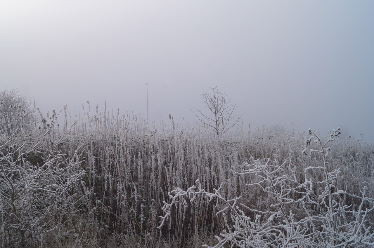
You feel like you are allowed to be here without seeking permission. You can wander and explore and not be bothered. Today it feels timeless, an island in a fog that not even the sound of traffic from the A47 and Wisbech Road can penetrate. It’s mid-morning on a weekday and there’s no one around despite the town centre sitting less than five minutes walk away to the North. No sign of modern life, but it is living. It’s a harmonious wasteland of gentle lawlessness. Today all of the boundaries are invisible and the misty seclusion is liberating.
 Approaching from the South, walking down from the bank that runs along the busway and looking across the land, towards the Boal Quay, you can already see a wreck – the remains of a small wooden boat. This is now a marker, a relic to show where the water of the Nar once flowed out in to the Ouse.


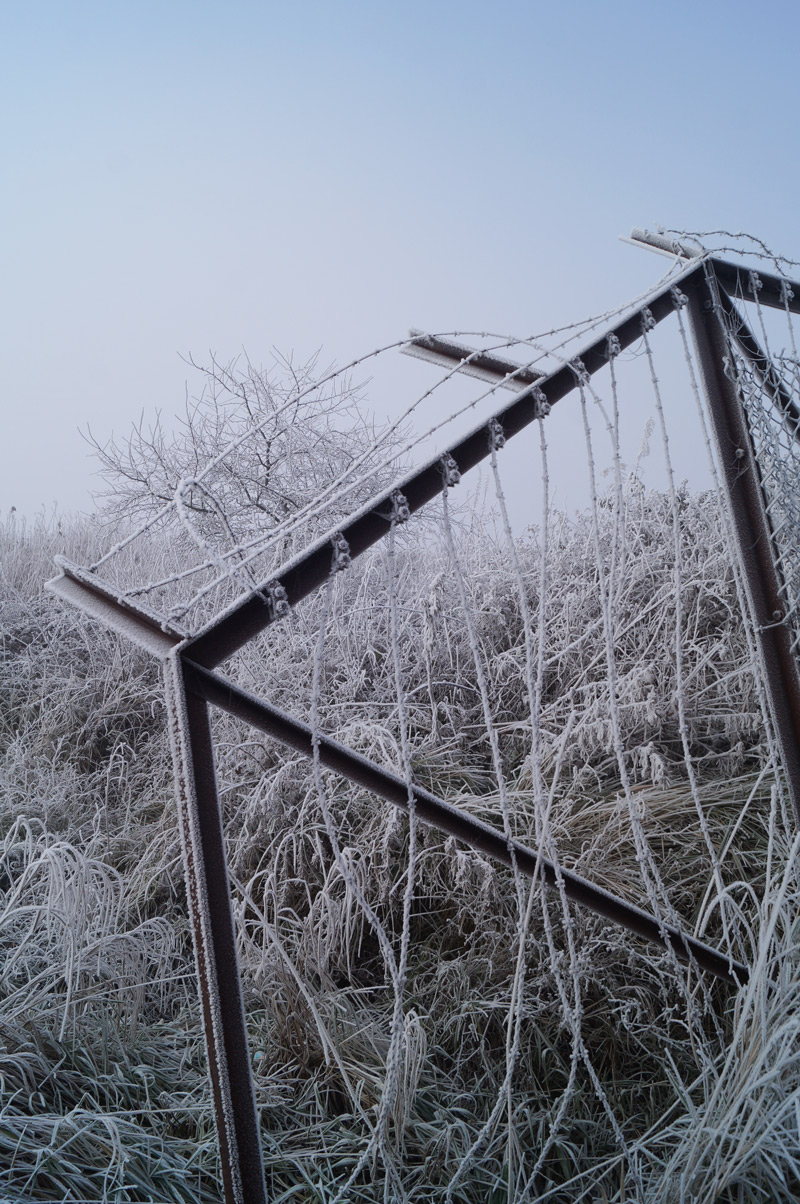
To the right, there is a clear worn path that takes you around the outer edge of the loop, following the busway before bending left, running beside the Boal Quay car park all the way to the end of the quay. Taking this path, you will circumvent the reeds and come to a small metal ladder just before the quay. You can use this to get down and avoid having to cross the channels to get to any of the abandoned vessels.
At the bottom of the ladder you will see discarded cans and bottles amongst other rubbish; evidence that this land is frequently visited despite, and maybe because, of it’s seeming desolation.


To the left of the closest wreck, a lesser-trodden route is visible. This path takes you north across the higher land into the inside curve of the loop, between the former north and south flowing stretches of the Nar. This path follows the former Harbour Branch line that ran from the former Harbour Junction and South Lynn Station. In the Nar Loop at least, no evidence or relics from this line exist; the bridge dismantled long ago.
If you follow this path, there are concrete steps and the end to take you down a level to the tidal land.


There is a third path, even less travelled but still apparent. This takes you west towards the river and then around the furthest wall where you can see some basic graffiti that is not visible from the east.
These two paths both involve getting across the remaining channels (empty or not, depending on tide) to get to the boats.

One of the makeshift bridges across one of the tidal inlet channels
There are a couple of short makeshift bridges improvised from wooden planks to help with crossings and you will have to cross at least one. These are precarious as they appear and are not to be trusted. It would probably be safer to make a small leap if you feel capable. These can also be avoided if you take the well-trodden path around the outside of the Nar Loop, running next to the wall that takes you past the reeds.


It’s not advisable to explore the reeds, which now make up half of the Nar Loop, given that you cannot see where you are walking, and the disturbance to the wildlife.
There is signage to warn that the land is subject to tidal waters. The land in the part is mainly weeds and grass but you need to watch your step as tidal river water from the Ouse still meanders through in channels. Take a look at recent satellite imagery (Google Maps / Earth) to get an idea of where they are.

The Nar Loop from above from 1946 – 2018
The most obvious of the vessels, now a hulk, is a large boat that has been grounded for at least 20 years. At one point it was converted in to a house boat, before succumbing to a fire in May of 2018 although it still appears structurally intact. It’s recent vacancy probably works in favour of the future plans for the Nar Loop, which would probably have caused complications with regards to developing the site.

lettering on the wreck of the ‘Brogozmazadoug’
Another, smaller, vessel sits further along in a more dilapidated state. The name ‘BROGOZMAZADOU.G’ can only just be gleened from the ghost lettering. This could to be a reference to ‘Bro Goz ma Zadoù’ (Vieux pays de mes pères – The land of our fathers), an unofficial national anthem of Brittany.
Future
Plans and proposals drawn up for the redevelopment of this area in the past and have evolved over time based on public consultations. The most recent concepts proposed include a wetland habitat in, but come with no certainty that the current natural features of the Nar Loop will be preserved.

artist’s impression of the Nelson Quay South Quay redevelopment

overview of Nar Loop with wetland | West Norfolk Council
The most recent went to public consultation in 2018 with a formal planning application expected early 2019. It will be part of a larger development that has a working title of ‘Nelson Quay’ and work could begin in 2020.
Details of the future plans for the Nar Loop, Boal Quay and South Quay can be seen here. With the exhibition boards available here.
It’s inevitable that land like this will be developed and built on, further evolving as the local commercial and domestic demands change. It’s current form shaped by past industrial needs and the natural meandering course of water.
After the drastic upheaval and interference of the previous century however, it seems to now be at a tranquil equilibrium, balanced between a natural feature and a resting place where spectres of vessels, still recognisable, harmlessly decay in a secret wilderness hidden in plain sight.